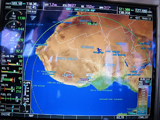
A recent picture of the display in the Kodiak shows two green circles or range rings which equate to where we can get to with the fuel load we have on board - dotted line is with 45 mins fuel left and the solid line indicates maximum range.
North is up to the top right and Cape Town is to the left. We had already flown about an hour when the photo was taken but you can see we still had enough to reach just about anywhere in southern Africa with a range at this point for almost another 1000nm. You will also notice that we had just over 3/4 tanks and a slight quartering head wind at the time.
The Garmin 1000 is really quite clever and works out the wind speed and direction and takes that into account when displaying the range. A strong wind would give you quite an oval green 'circle' as in the pic below.
This above flight was helped by a hefty 32kt tail wind and helped us work out that we didn't need to stop in Pretoria (WB) for fuel as we could make it easily to Nelspruit (FAKN) and could even continue to Maputo, Mozambique if we wanted without going into our reserves. Without knowing the wind and the range it might have been a different call and would have cost us time and money for landing fees etc as well as another cycle on the engine.
The pic below shows we are in a valley that opens out 4nm ahead.
The synthetic vision on the main screen also shows this...
 |
| How handy is that! |
There's a stack of other clever things it does but before anyone asks, no, it does not make coffee and no, you can't get satellite TV on it - there are limits!
 |
| General cockpit view |
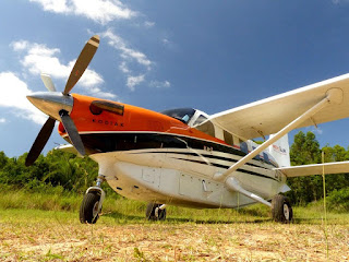
It's really a thank you to those many people who in some way, large or small, helped Mercy Air obtain the Kodiak in the first place. Because with it, we can now not only do what we were doing before - and more, but we can do it more efficiently and with a greater margin of safety.
 |
Paul and Cathy


